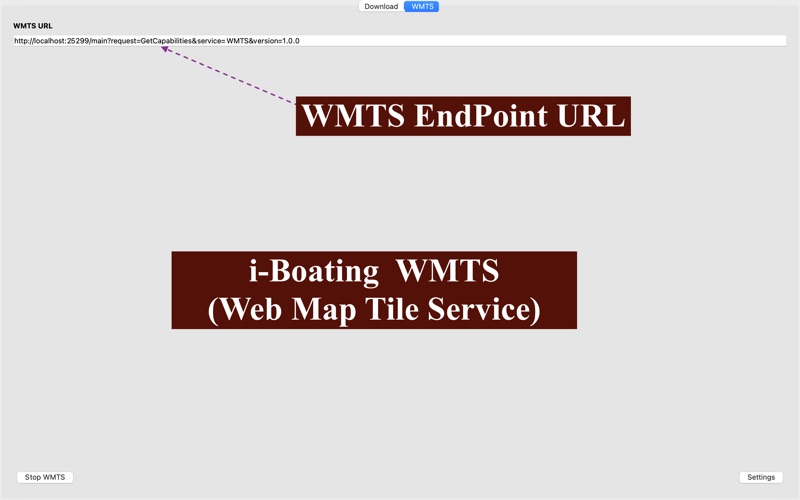
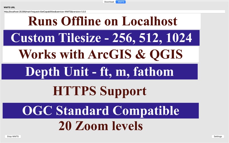
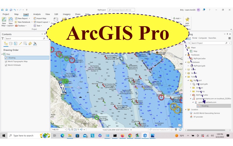
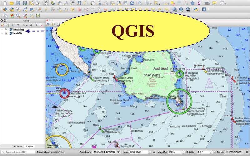
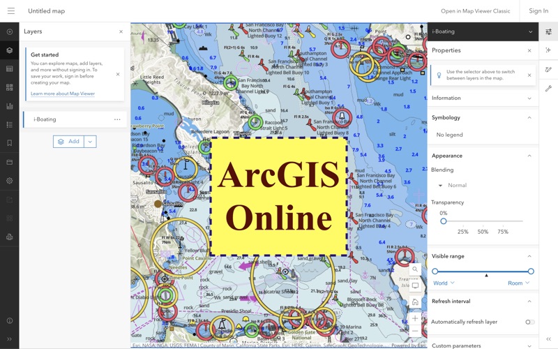
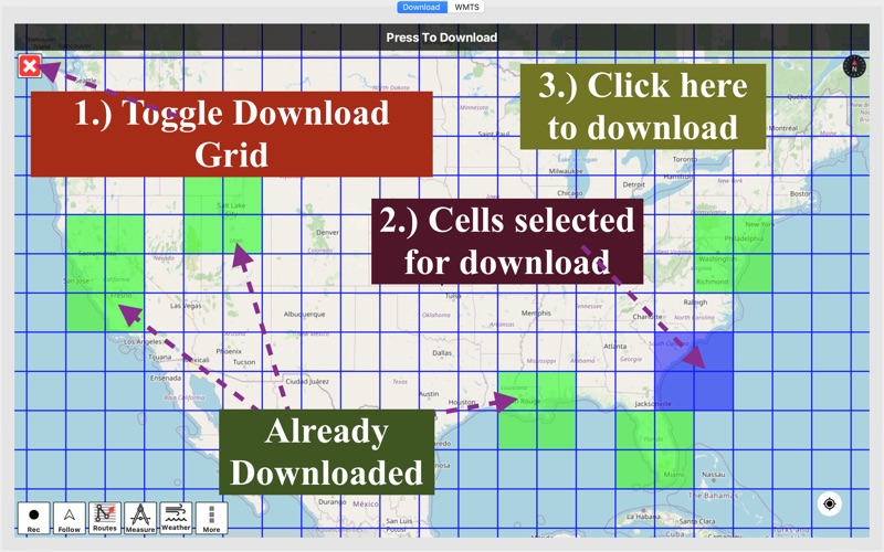
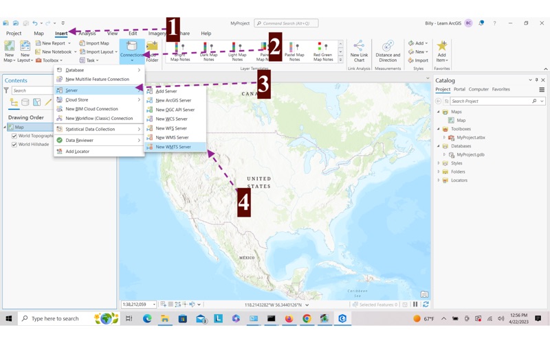
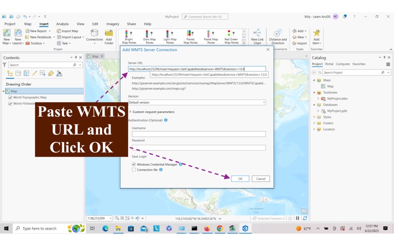
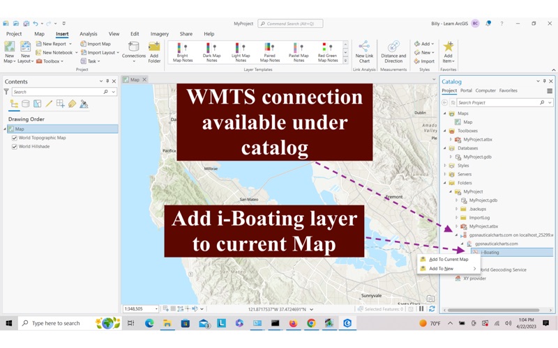
The i-Boating WMTS is a dynamic web map tile service for private internal use that runs on your computer and provides coverage for marine charts and lake depth maps. It's the most customizable marine WMTS and compatible with QGIS, ArcGIS, ArcGIS online, Grassgis, Leaflet, Openlayers and any software compatible with the OGC WMTS standard. ►SALIENT FEATURES √ Compatible with ArcGIS Pro, ArcGIS Onlne, QGIS, GrassGIS & more √ Offline support: Designed for private internal use to run on your localhost even when offline √ Change depth unit to feet, meter or fathom √ Tile size can be customized to 256, 512 or 1024 √ Both http and https support:For https, add your own SSL certificate or use our bundled self-signed certificate √ Compatible with most GIS software and web - applications including QGIS, ArcGIS, ArcGIS online, GrassGIS and platforms like Here Maps, Google Maps, javascript libraries like Leaflet, Openlayers etc √ Choose between Light and dark mode √ Custom depth offset √ Custom shading √ Option to use an offline basemap √ Capable of serving maps till zoom 20 ► HOW IT WORKS Its a 2 step process: 1. Download charts: The i-Boating WMTS requires grid cells covering your area of interest to be downloaded. 2. Run WMTS: When you run the i-Boating WMTS, it give you a URL (aka the WMTS endpoint). You can copy paste the URL when adding a WMTS layer in your GIS application/web app. ► MAPS It includes unlimited updates for 1 year. √USA: The maps include coverage of all NOAA marine vector charts (ENC),USACE inland river maps,freshwater lake maps for more than 7K lakes. The charts include HD/1ft/3ft bathymetry where available.Incl. NOAA raster where ENC not available. √Canada:Incl. CHS data(incl. major Lakes). √UK/Ireland: Derived from UKHO charts. √Australia √Germany: derived from BSH data √Europe Inland Rivers:Donau/Dunaja,Rhine,Garonne,Moselle,Drava,Sava,etc √Norway √Finland √Sweden √Croatia √Caribbean √New Zealand √Spain √Brazil √Argentina √Cyprus √Falklands √Seychelles& Mauritius √Denmark √Malta,Cyprus & S. Mediterranean √S. China&Malaysia √South Africa